Service Area Analysis: Service Area Coverage
Tjenesteområdeanalyse: Tjenesteområdedekning
Project Overview
Prosjektoversikt
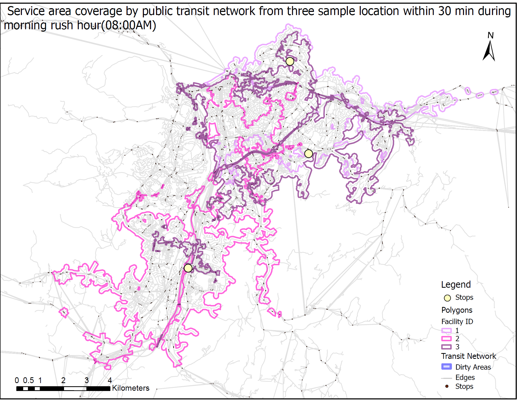
In this project, the public transit network dataset, the employees_100 grid from the PT dataset, the Pop_gridpoints2019_250 from Trondheim_region.gdb, and service area analysis were used to calculate and compare the number of inhabitants and employees reachable from the three sample facilities named City Lade, City Syd Kjpesenter, and NTNU Dragvoll by public transit within 30 minutes at two different times of the day.
The analysis was performed using service area network analysis on March 20, 2023 at 8:00 a.m., with a 30-minute cutoff and the public transit time set as the cost impedance.
The finding from the analysis show that a total population of 74179, 85794 and 83940 and a total number of employers of 1803,2370 and 2175 can be reached from the three sample facilities including City Syd Kjpesenter, NTNU Dragvoll and City Lade respectively by public transit within 30 minutes. In addition to that the above map shows the total area coverage that can be reached from the three sample facilities by public transit within 30 minutes.
I dette prosjektet ble datasettet for kollektivtransportnettverket, ansatte_100-nettet fra PT-datasettet, Pop_gridpoints2019_250 fra Trondheim_region.gdb og tjenesteområdeanalyse brukt for å beregne og sammenligne antall innbyggere og ansatte som er tilgjengelig fra de tre prøveanleggene kalt City Lade, City Syd Kjpesenter, og NTNU Dragvoll på to forskjellige tider av kollektivtrafikken på 30 minutter.
Analysen ble utført ved bruk av tjenestenettverksanalyse 20. mars 2023 kl. 08.00, med en 30-minutters cutoff og offentlig transporttid satt som kostnadsimpedans.
Funnet fra analysen viser at en total befolkning på 74179, 85794 og 83940 og et totalt antall arbeidsgivere på 1803,2370 og 2175 kan nås fra de tre prøveanleggene inkludert City Syd Kjpesenter, NTNU Dragvoll og City Lade med kollektivtransport innen 30 minutter. I tillegg viser kartet over den totale arealdekningen som kan nås fra de tre prøveanleggene med kollektivtransport innen 30 minutter.
Tools Used
Verktøy brukt
ArcGIS, AutoCAD, Adobe Illustrator
Project Date
Prosjektdato
2022
Project Type
Prosjekttype
Urban Mapping Analysis
Bykartleggingsanalyse