Closest Facility Analysis: Minimum Travel Time
Nærmeste anleggsanalyse: Minimum reisetid
Description
Beskrivelse
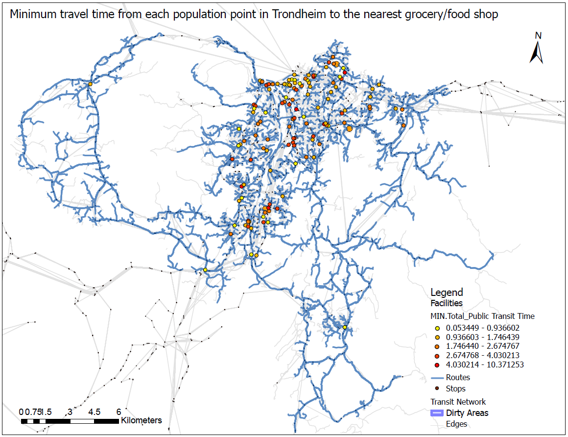
Using the public transit network dataset, Grocery/Food shops from the PT dataset, and closest facility network analysis were used to calculate the minimum travel time from each of the population points in Trondheim to a grocery or food shop. In the above map, the result shows the minimum travel time from each population point to the nearest grocery store is between 0.05 and 10.4 minutes using PT.
Ved hjelp av det offentlige transittnettverksdatasettet, dagligvare-/matbutikker fra PT-datasettet og nærmeste anleggsnettverksanalyse ble brukt til å beregne minimum reisetid fra hvert av befolkningens punkter i Trondheim til en dagligvarebutikk eller matbutikk. I kartet over viser resultatet at minste reisetid fra hvert befolkningspunkt til nærmeste dagligvarebutikk er mellom 0,05 og 10,4 minutter ved bruk av PT.
Tools Used
Verktøy brukt
ArcGIS Pro
Project Date
Prosjektdato
2023
Project Type
Prosjekttype
GIS Network Analysis
GIS Nettverksanalyse