Raster method of path distance: Pedestrian Accessibility Analysis
Rastermetode for veiavstand: fotgjengertilgjengelighetsanalyse
Project Overview
Prosjektoversikt
The study focused on creating pedestrian accessibility maps using the raster method of path distance. This method calculates travel time for different pedestrian types to access specific facilities.
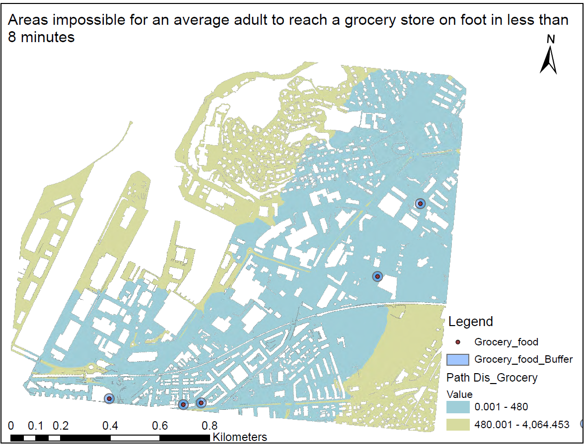
The analysis delineates areas where average adults pedestrians cannot reach grocery shopes within 8 minutes.For the analysis different data is used, which includes Cost_rast, Mask, Grocery/Food Shops, Hraster, and Resistance.txt. Finally, the areas that don't have access to the five groceries within 8 minutes for average adults are identified as shown on the map.
Studien fokuserte på å lage tilgjengelegheitskart for fotgjengarar ved hjelp av rastermetoden for stiavstand. Denne metoden berekner reisetid for ulike fotgjengartypar for å få tilgang til spesifikke fasilitetar.
Analysen avgrenser områder hvor vanlige voksne fotgjengere ikke kan nå dagligvarebutikker innen 8 minutter. For analysen brukes forskjellige data, som inkluderer Cost_rast, Mask, dagligvarebutikker/matbutikker, Hraster og Resistance.txt. Til slutt er områdene som ikke har tilgang til de fem dagligvarene innen 8 minutter for gjennomsnittlige voksne identifisert som vist på kartet.
Tools Used
Verktøy brukt
ArcGIS Pro, Path Distance Spatial Analysis tool, Buffer Analysis tool
Project Date
Prosjektdato
2023
Project Type
Prosjekttype
Accessibility Analysis, Raster Modeling
Tilgjengelegheitsanalyse, Rastermodellering